.

.
HOME OF THE LADY DENMAN - Local history isn't always about the big story - the everyday story of life in the early development of the region can be a fascinating, entertaining and educational journey.

30 December 2014

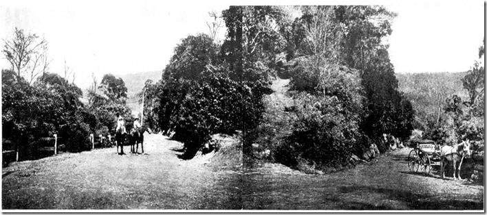
The road across Cambewarra Mountain 1903.

With it’s winding, tight bends, and magnificent scenery, the road between Nowra and Kangaroo Valley is still a challenge that requires respect. If you can imagine back in 1861, the difficulties faced in constructing this road through thick bush and steep gorges, then imagine the time it took to travel on horseback and buggy.
This vital link from the southern highlands to the coast was started in 1861, and soon became a popular tourist destination and a vital link to the coast for the valley settlers.
kangaroo-valley
To Nowra

To the lookout

To Kangaroo Valley


This amazing photo was extracted from the Sydney Mail February 11 1903.

Twilight Markets.

This Saturday the 3rd January the Lady Denman Museum will have it’s annual Summer Twilight Markets
4pm - 8pm…lot and lots of stores and entertainment….
Bring the family for a fun evening.

Message in a bottle discovered in Wreck Bay.

“On our way to South Africa to participate in the fighting there”.
I recently came across this little story in the Shoalhaven News and South Coast Advertiser Saturday 23rd June 1900.


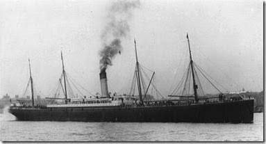
A sea message from B.Squadron of the Imperial Bushman’s Contingent on board the Armenian was picked up by Mr. Christian Elmos, of Sussex Inlet, St St Georges Basin, on the 13th instant, in wreck bay. It was enclosed in a bottle, and although water had obliterated some of the writing the following could be readily deciphered.
'” Bass Straight, April 26, onboard the troopship Armenian. On our way to South Africa to participate in the fighting there. All are in good health, and we are thoroughly enjoying ourselves. We wish those that pick this up long life and prosperity. Signed by troopers, P.J.S. Ryan, Tom W. Cressy, W.Wright, T.A Rushton, and R.G, Blackbutt (sergent), and H.H Dolman (corporal).”

The Armenian left Sydney on the evening of April 24, and arrived at Beira, South Africa, on May 17.
ss_armenian


REF: https://anmm.wordpress.com/tag/ww1/

The bottle message was thrown over in Bass Straight on the 26th.
By that date the Armenian would be well in the straight on her way to Albany, her first port of call from here.
As a fact the steamer passed Gabo Island at 9.30pm on the 25th, and at 10 minutes past 7 next morning (the 26th, date of message) reported at Wilsons Promontory.

The bottle travels 330 miles before being cast ashore at Wreck Bay.

The finding of the message has thus a special interest aside from which appertains to it’s contents, in that it proves the direction of the current at that particular time of year – a direction which in this instance disproves the somewhat commonly accepted belief that the current along this coast close in shore invariably runs to the southward. Assuming that the message was floated from the Armenian at 7 am. on the 26th, it travelled approximately 180 miles nearly due east, to Gabo Island, then turned N.by E. and came up the coast 150 miles before being cast on the shore of wreck bay.

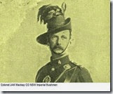
Colonel_Mackay These men were heading to South Africa to fight in the Boar War -1899 - 1902


NSW IMPERIAL BUSHMEN/6TH IMPERIAL BUSHMEN

  • Original strength: 762
  • Subunits: six mounted rifle squadrons
  • Commanding officers: Colonel J. A. K. Mackay, then Lieutenant-Colonel H. Le Mesurier
  • Left for South Africa: 23 April 1900 on Armenian
  • Service: May 1900 - May 1901 in Rhodesia under Carington and west Transvaal including capture of de la Rey’s convoy and guns at Wildfontein (24 March 1901)
  • Fatal casualties: 13 killed or died of wounds, nine died of disease
  • Decorations: one CB (Mackay), four DSOs (H. H. Browne, R. D. Doyle, W. E. O’Brien. K. Wray), one DCM (P. J. Moy)
  • Returned to Australia: 17 July 1901 on Orient
  • Useful sources: regimental order books (State Records NSW, 4/7649-51), Mackay papers and H. S. Targett papers (Australian War Memorial, PR87/207 and PR88/171)

    REF: http://www.bwm.org.au/site/Contingents.asp
  • The Shoalhaven News and South Coast Districts Advertiser (NSW : 1891 - 1937), Saturday 23 June 1900,
    page National Library of Australia http://nla.gov.au/nla.news-article135728081

27 December 2014

Huskisson Pool.


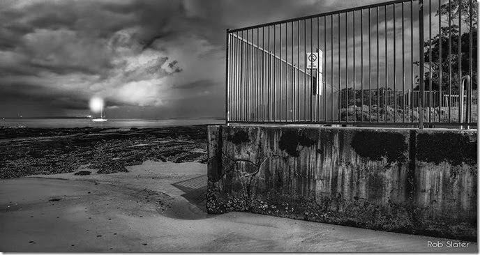
A storm passes the bay late at night, a masthead light on a gently rocking yacht and the cold weathered concrete wall of the Huskisson poolhusky-pool-bw make for an interesting scene.

26 December 2014

Jervis Bay – Moona Creek footbridge.

1903 Life around the bay hadn’t changed a great deal from the early 1800’s. The biggest change was the growth in tourism. The shipbuilding industry led by the Dent family was in decline. The Dents themselves started to diversify and cater to the growing tourists. The bay was becoming popular with holiday makers, encouraged by numerous newspaper articles written by traveling correspondents calling attention to the beauty of this untamed landscape.

”Where the weather came from”.
Before this media attention,  Jervis Bay to Sydney-siders was only known as ‘where the weather came from”

42-Footbridge-over-Moona-Moona-Creek

Today without much effort we can travel easily between Huskisson and Vincentia. In 1903, what we now find so simple, presented considerable challenges.

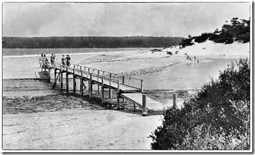
2015 - Moona Creek, is passed over every day by hundreds of travelers, in 1903 Moona Creek presented quite an obstacle, always flowing with water and surrounded by low lying wet land, the only way to get between Huskisson North and Huskisson South (now Vincentia), was to take a long and winding journey inland around the far reaches of the creek or wade across the creek at low tide.

”Looking with longing eyes”.
Below is from an article in the Shoalhaven Telegraph, Wednesday 7th January 1903.
A correspondent writing from Jervis Bay, wishes to draw attention, through the columns of the Telegraph, to the great need of a foot bridge across Moona Creek. Now that Jervis Bay is becoming a grand place for tourists, it would be a great boon, he points out, to many if they could extend their walk along the beach beyond the creek mentioned. He noticed, when at Moona Creek on New Years Day, numbers of ladies and gentlemen looking with longing eyes to the beach beyond, and, no doubt, wishing to get across. It would only take a few pounds to do all that is necessary.


Footbridge-over-Moona-Moona-Creek 
It took another 23 years before a foot bridge was erected in 1926. Remnants of the bridge can still be discovered projecting from the rocks. The bridge was eventually washed away in a flood.


Continue reading about Moona Moona Creek.


image


22 December 2014

Cape St George Lighthouse 1873.

Despite its isolation, and what appears to be a confusing journey on unmarked tracks, numerous newspaper correspondents of the time suffered the difficulties and made their way to Cape St George.
Before cameras, correspondents would be accompanied by artists, whose task it was to sketch the scenes they arrived at. Newspapers from the 1800’s give us beautiful hand-drawn images of many places along the south coast. The lighthouse appears to be a popular destination for the above, appearing in many issues of country and city papers.

Short paragraphs read in isolation, can reveal an insight into life around Jervis Bay.

The image and article below is from the Illustrated Sydney News, 1873.

image


image 

This building is situated about thirty miles from the town of Nowra, in New South Wales, on the south side of Jervis Bay, and is the direct rout of vessels proceeding from Sydney to Melbourne. The light shown is a bright revolving white and green.
The road winds along the edges of swamps and over rocky hills, and at the time our illustration was made not marked out, and our artist and his companions were, in consequence, obliged to put up their tent and pass the night in the bush, having been unable to find the way before it became dark.
As it was a moonlight night, two of the party searched around the camp, and followed a path which they discovered. Coming back with their cloths and boots wet and muddy from the small streams of water they had crossed, they made a fire and cooked their supper.

A bed of rushes served to sleep upon, and the wild howling of the native dogs did not long keep them awake.
Next morning, at sunrise they breakfasted and started for the lighthouse, but the horse stopped at the first high sand hill and part of the luggage had to be left on the road. With some difficulty the spring cart was drawn to the coast, and the superintendant kindly sent his own horse for the articles left behind.

The tent was pitched near the stable of the establishment, and during the next fortnight a series of drawings were made of the wild and beautiful coastal scenery, including the lighthouse.
Although the headland is a great height from the sea, in a storm the foam dashes right over it; and once, when a strong wind came on, the party had to raise from their beds in the midst of a pouring rain and secure the fastenings to prevent it’s being blown over the cliff.

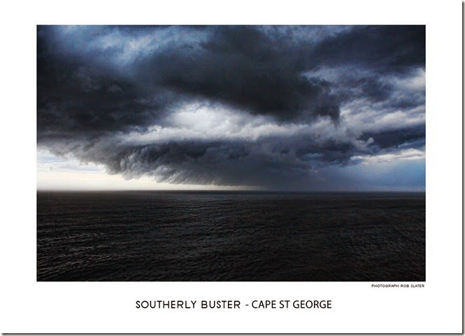
Passing storm taken from the exposed Cape St George headland.image-0116
Following he gives us and insight into the hardships and inadequate facilities the lighthouse keepers endured in their daily tasks.

The want of a verandah to the superintendant’s quarters is much felt in wet weather, as there is no shelter either from the rain or foam when he has to be on the lookout for vessels. Neither is there a spare room for ship-wrecked persons or strangers, as there should be as such and isolated station.

It’s hard to imagine a time when children might have been in such isolation, facilities must have been very primitive with regard to their education.

At a mile distant a schoolhouse has been erected for the children of the fishermen, who live a few miles off, and of the officials stationed at the lighthouse.

The entrance to Jervis Bay is two miles wide, and inside there is a harbor from three to four leagues in length and two in width. It is considered a safe port of ships of all sizes and is 80 miles from Sydney. The harbor is large and commodious, easy of access, and will affords shelter from all winds, having room for 200 sail of ships, with plenty of water and wood.

The bay was discovered by Lieutenant Boen, in August, 1791.

Hoping to visit the picturesque village a future time, the party left the coast when they had completed  their sketch, and with the aid of a lent horse reached Nowra, much pleased with the kind attention from the superintendant while visiting the lighthouse.

Elyard, Samuel, 1817-1910. Cape St. George Lighthouse, South of Jervis Bay, New South Wales, ca. 1864 [picture]


  • Elyard, Samuel, 1817-1910.
  • Cape St. George Lighthouse, South of Jervis Bay, New South Wales, ca. 1864 [picture]
  • ca. 1864. 1 watercolour ; 36.2 x 56.2 cm.
    http://nla.gov.au/nla.pic-an2686423


    Meaning
    League - On land, the league was most commonly defined as three miles, though the length of a mile could vary from place to place and depending on the era. At sea, a league was three nautical miles (about 5.6 km).


    image


  • 19 December 2014

    Launch of the General Garfield 1882

    As the ringing cheers of the visitors went forth, the top mast steamer unfurled the name “General Garfield”.
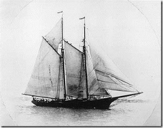
     1894photo-Morrissey


    Example of a fore-and-aft rigged steamer.


    The firm of Messrs. James Dent, shipbuilders of Jervis Bay, have added another to their large fleet of schooners and crafts, built at Jervis Bay.
    On Saturday last as previously notified, the launch of the latest triumph in the shipbuilding craft too place, At an early hour there were a large number of visitors congregated from far and near. The vessel about to be launched was handsomely and liberally decked with bunting, the “Star and Stripes” occupying a conspicuous place, at the top of the main mast was furled the streamer, bearing the name which was to distinguish the vessel; and many an eye was turned towards the vessel as the time for the christening ceremony approached.

    9.30 the “trigger” was struck.

    And as the handsome craft began to glide smoothly down the ways, Miss Bessie Longfield, of Sydney, gracefully performed the christening ceremony, by breaking a bottle of cognac over here bow; as the ringing cheers of the visitors went forth, the top mast streamer unfurled the name General Garfield.
    The launch was most successful, the vessel gliding smoothly into the water, without the slightest lurch from the perpendicular. The vessel having been moored the visitors were liberally treated to refreshments and success to the vessel and her builders was pledged in many a bumper.

    On many occasions launches were often celebrated with a local dance, games, even shooting contests near the beach have occurred.
    In this case, at noon, the visitors were invited to Mr. George Dent’s, where an excellent lunch was partaken of. The newly launched vessel is 100tons burthen, and was all ready for sailing as regarded rigging, etc.
    In the afternoon a handicap pigeon match for a silver cup, value 8 pounds, came off, the winners being Mr James Dent, who was closely pursued for first place by his youngest brother, Master R.Dent.

    Garfield dimensions.
    Length over all 78ft: Keel 72ft: hold 8ft: beam 20ft 6in: The General Garfield is rigged as a fore-and-aft schooner, and is intended for the Sydney to Jervis Bay trade.
    This vessel brings the aggregate tonnage of vessels launched by Messrs, Dent at Jervis bay, during the last 18 years to upwards of 3000 tons.
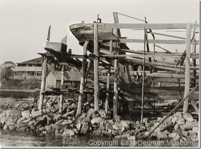
    1417-Construction


    The Dents yard was not a place for idle hands.

    Besides the one just mentioned the Brothers Dent have the hull of a pleasure boat – a steam launch of considerable dimensions, well advanced which they are building, to the order of Mr. Dent, son of Sydney.

    Meaning of:
    A
    Fore-and-aft schooner is rigged solely with fore-and-aft sails. Two masted fore-and-aft schooners are small, fast and handy vessels, often used as fishing vessels in the 19th century.
    A fore-and-aft sail is a sail that can take the wind from either side of the sail, depending on the direction of the wind, as opposed to the square sail that is always turned so that it takes the wind on the same side of the sail.
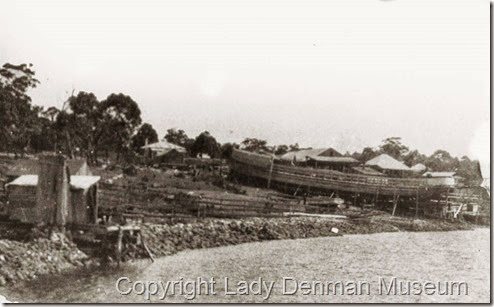
    629-Currumbene-Foreshore
    Currambene creek
    Huskisson.


    The Garfield’s story doesn’t stop there. for many years she plied the N.S.W coast, being well known and highly regarded as a fine ship.
     

    Lucky escape 1989.
    Seven years after being launched, the Garfield, almost became a total wreck on the Manning Bar, where incidentally, she had almost been wrecked some time earlier, both incidents had her sitting on the bottom half full of water but was able to be refloated and repaired. “A lucky escape.”

    Garfield’s luck ran out in 1998.
    Her luck ran out in December 1898 after leaving Duck River,Tasmania and sailed thence on the 1st November to Adelaide. Contrary winds and rough weather caused him twice to seek shelter; leaving Hunters Island on the 11th. Shortly before midnight the alarming discovery was made that the land was only 5 miles to leeward. The master who was steering attempted to tack ship. Owing to the strong squally winds and heavy seas the vessel missed stays, and set rapidly towards land.
    Nearing the shore the anchors were thrown out, but would not hold, and the Garfield struck on a sandy bottom sixty fathoms from the shore, on which a heavy surf was beating.


    The crew had great difficulty in preventing themselves from being washed overboard by the sea which was continuously dashing over the vessel.
    When daylight appeared all hands numbering five, landed in the boat, thankful for their escape.
    It was found the vessel has struck on Lavinia Point, 12 miles from Wickham lighthouse, they camped there three days, and went to Wickham where they were received with great kindness.
    The Garfield was launched in Jervis Bay in 1882 and till recently was in the New South Wales coastal trade.

    January 18th 1899. 
    Mr. Lyall arrived at the wreck site in January  18. He found the vessel lying with her bows to the beach, with a list of 7ft to starboard. For several succeeding days the 5 men employed were busy discharging the blackwood logs and effecting what repairs were necessary. the hull was comparatively uninjured..
    A kedge anchor was run out and all was in readiness for launching the schooner.
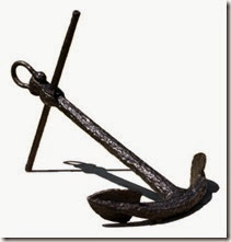
     ketch anchor

    Ketch Anchor.


    February 12th 1899.
    A strong easterly gale sprang up. A heavy sea was raised and the breakers carried away the decks of the wrecked vessel right from the stern to the middle of the main hatch, the masts disappeared over the side, the vessel “bilged.” and her owner was reluctantly compelled to abandon her.
    He left the scene of operations and the Garfield became a total wreck.

    What caused the Garfield to stray off course and become a total wreck.
    Official findings and judgment.

    At Carrie harbour and inquiry was held into the cause of the wreck.. The captain in his examination, attributed the wreck to the strong currents prevailing in the straights, which had been setting him ashore. After hearing the evidence of the crew the court acquitted Captain Peterson of all blame.
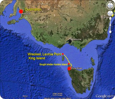
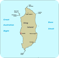
    map-1 King_island_map


    Meaning:
    Missed Stays – An unsuccessful attempt to tac.
    Fathom - A unit of length equal to 6 feet (1.8 m), roughly measured as the distance between a man's outstretched hands. Particularly used to measure depth.
    Bilged - To spring a leak in the bilge.
    Bilge - Is the lowest compartment on a ship, below the waterline, where the two sides meet at the keel.
     

    18 December 2014

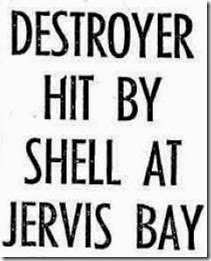
    HEADLINES - CANBERRA TIMES SEPT 15 196O.

    tobruk 


    HEADLINE

    Anyone who has lived around the shores of Jervis Bay can attest to the nose and vibrations that reverberate across the bay when the navy is conducting naval shooting exercises.
    The sounds are recognizable to everyone, repeated low intensity thuds, vibrations, that can have your windows rattling, unaware visitors can be surprised at the intensity.

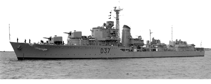
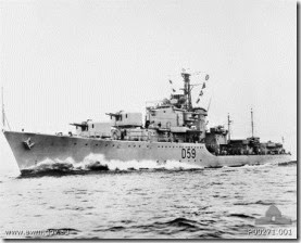
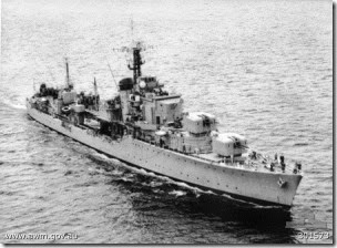
    In 1996 while conducting one of these exercises H.M.A.S Anzac, shelled and holed her sister ship H.M.A.S Tobruk, in a practice shoot.
    Anzac was using Tobruk as a target with the guns set to land the salvo 6 degrees astern or ahead of the ship, this is called a “throwing off” exercise.
    A malfunction in Anzac '​s gun direction equipment negated the deliberate 6° mis-aiming of her guns and a 4.7 inch shell ripped into Tobruk’s half inch steel plating near the water line, fortunately they were using practice shells that don’t contain explosive.

    Water flooded the engine room to a depth of 14ft.
    There were no casualties, but the Tobruk’s engine room crew had to be hurriedly evacuated to avoid being trapped, pumps helped reduce the water while Anzac took Tobruk in tow and bought her back to Jervis Bay.

    She limped back to Sydney, where it was found she was damaged beyond economical repair and was decommissioned that same year, and sold for scrap in 1971.

    H.M.A.S Anzac                                        H.M.A.S Tobruk.
    HMAS_Anzac_1960 HMAS_Tobruk 1960

    16 December 2014

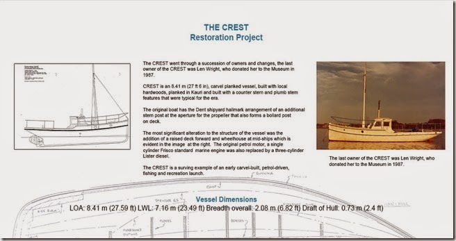
    Crest Restoration Project

    A new exhibit is gracing the walls of the Museum.
    The Crest is a surviving example of an early carvel-built, petrol driven fishing and recreation launch.
    The Crest is undergoing a complete restoration from the keel to the top of the mast head.
    This exhibit outlines some of the work that has been done so far during this ongoing project…
    panel-2

    Summer Exhibition 2014 -2015

    JB Arts present REFLECTED
    Where -  Vera Hatton Gallery.
    When – 10am-4pm daily.
    banner

    15 December 2014

    Lost.

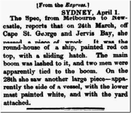
    Most ship wrecks are reported, either by survivors or other passing vessels, other times wreckage is found washed up on the shore that has a name plate or some other identifiable signal attached, bodies are recovered with identifiable objects, all these let the authorities know that there has been a tragic loss.
    Other times unidentifiable wreckage is found, imparting a feeling of melancholy .
    This small easily missed article appeared in the South Australian advertiser in 1870, it’s a poignant reminder of how harsh and dangerous times were in the early days of seafaring.
    The South Australian Advertiser (Adelaide, SA : 1858 - 1889), Saturday 2 April 1870, page 2

    10 December 2014

    Southern Pencillings - By the Raven.

    A trip to Jervis Bay1883. Australian Country Journal.
    I will post this article written by the correspondent then know as ‘The Raven” in parts.  It’s quite long but takes you back to a time when things moved a little slower.
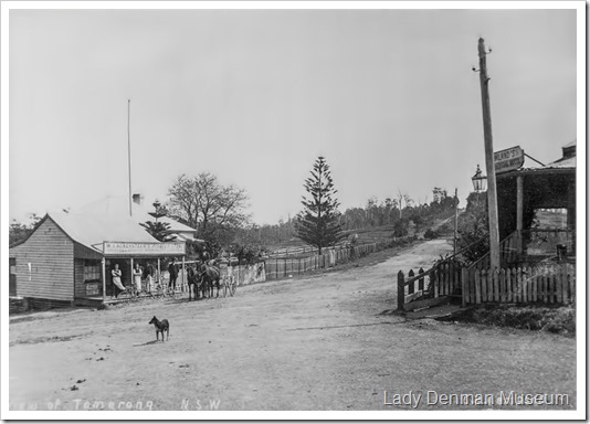
    The article starts off by talking about his stay at the small village of Tomerong in the Travelers Rest Hotel opened by John Parnell in 1857. With the opening of the new southern route to Ulladulla Tomerong became the most important centre between Nowra and Milton, Parnell opened the hotel to cater to the commuters along the road. By 1862 Tomerong had it’s own school, post office and general store.
    In 2012 the school celebrated it’s sesquicentenary, 150 years 1862 – 2012.
    221-Lackersteen's-Pioneer-Store,-Tomerong-a
    p1

    Waking up in Tomerong.
     

    “It is early morning at Tomerong, the patter of the rain on the roof and against the window is the only sound to be heard, it’s painful regularity palls upon the ear.
    Rising from bed and drawing up the binds, I notice that a uniform, dull laden hue pervades everything outside, there is evidently no sign of it clearing up today.

    Despair seizes me - This makes the fifth day of imprisonment at Tomerong.Raven was clearly getting frustrated by this time, Tomerong was only around 5 miles away from his objective Jervis Bay, but with the state of the roads and lack of transport it might as well have been a million miles away.

    Tomerong a place, under the most favourable circumstances, not calculated to inspire one with cheerful thoughts, Without companions and the books, except an ancient Robinson Crusoe, have three days of miserable incarnation been passed. The spotted china dogs, with guilt collars, and an expressionless stare, which are seated on the mantle piece and the fashion plates on the wall, for the year 1856, in which are several females, also expressionless and in balloon like attire are depicted, now cease to attract. Although the middle of November, a fire is not only welcome, but almost indispensible.
          For the sake of those who have never heard of Tomerong, I may say it consists of a public house, with post office adjoined – wise combination – school, and church, and that it is situated on the road between Shoalhaven and Ulladulla.
    My object in coming here was to visit Jervis Bay, the nearest point of which, viz., at North Huskisson, is only about five mile distant.

    The rain finally clears and his journey continues to Jervis Bay.

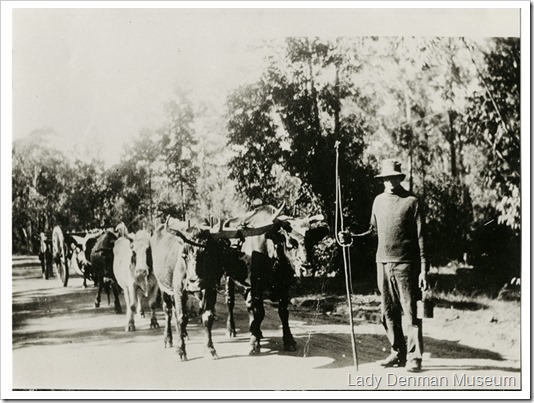
    Accordingly the following day, the rain having at least ceasedand there being every prospect of fine weather, I set off for the bay in a buggy kindly placed at my disposal by my land lord (Mr Parnel), a well known identity. Very little, if any good or even cleared land is passed through on the road; the timber principally spotted gum and blackbutt, being of more value than the land upon which it grows, Several timber wagons drawn by bullocks are to be met with; timber getting being one of the main industries of the neighborhood”.

    94a    


    To be continued,
    Entering Huskisson.


    part-2-badge
    Finally, the Raven reaches Jervis Bay.
    government-school-at-huskissonJust upon entering North Huskisson, one’s attention is attracted by an evidently poverty stricken little humpy leaning over so much as to require propping up by saplings. This, I am surprised to learn is the Government school, and has an attendance of 40 scholars. A new building was promised 12 months ago.
    The small village of North Huskisson is situated at the north of Jervis Bay. at the mouth of Currumbene Creek. Shipbuilding is it’s main industry, the chief firms interested in this employment being those of Messrs. G. Dent, Thos, McCall and A Conlon respectively. Almost every description of craft is built by these firms; the favourite varieties of wood used being spotted gum for sailing vessels and pine for steamers. There is also a fair sized sawmill here.

    A howling wilderness the home of the dingo and curlew,is all that is left of South Huskisson, at one time a large and prosperous township, a mile and a half from the above. It was originated with the idea of it’s becoming the shipping port for Braidwood, but in this the inhabitants, it is, perhaps, needless to state, were disappointed; hence the desolation.St Georges Head at the south of Jervis Bay, where is situated the lighthouse, attracts a great number of visitors, and is a favourite resort of fishing excursionists, shark and schnapper abounding in the locality.
    It is some 15 miles distant from Tomerong, the nearest route being via St Georges Basin. a magnificent sheet of water, in shape and appearance reminds me of Sydney Harbour. On the north bank of this lake, or, more correctly speaking, arm of the sea, or, what would in Norway be called a “fjord.” are situated the estates of Messrs. William and Alexander Brice, to of the earliest settlers in the village. These two estates adjoin and together comprise 2560 acres, upon which dairying, as well as a small amount of agriculture. is carried on; They are well watered by the Wandandyan and several other smaller creeks.

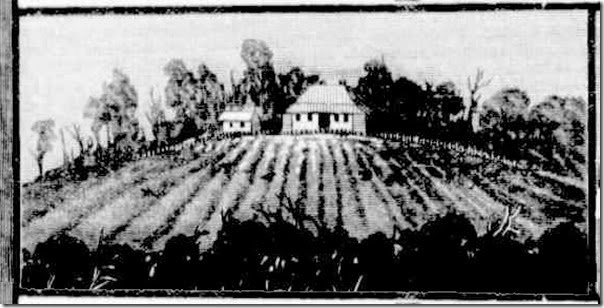
    A sketch of the residence of Mr. Alex Brice done by “Raven” during his trip.
    farms


    A day on the Basin.

    Being a guest under the hospitable roof of Mr.Willam Brice, a days boating in the Basin is proposed, and of course, gladly acceded to. A short walk brings us to the creek, on the brink of which is a neat little boatshed. We launch our craft, and after half an hours pulling, emerge into the open, upon which the sails are set, and our rate of progress through the water consequently materially increased, there being a pretty stiff breeze bowing at the time. The southerly gales more than any other are felt here.
    The two or three fairy-like islands with which the Basin is studded are duly inspected and admired, for to see is to admire in their case.
    Mr Raven must have been duly impressed with what he saw that day, especially with the amount of birdlife.
    Water-fowl of almost every description are to be seen here.The well know instinct of the Britisher to kill is strong within me, but to satisfy this instinct were to break the laws of my adopted country, it being the close season. There is no law, however, against “running down” moulting swans. Although the sun had not long risen when we started on our trip, he had already been at rest for some time when we once more arrived at the little boat house, after a delightful and appetite-inspiring day.

    Clearly from the Raven’s description the Basin was a happy hunting ground for wildlife, other than fish, It’s hard to imagine now that people looked at swans as a resource for food, but there is other evidence included in other articles supporting this. 
     ST-GEORGES-BASIN-VIEW A sketch of the Basin done by “Raven” during his trip.
    To be continued. Horse hunting and a trip to St Georges Head.
    p3


    Hunting horses is a favourite sport of the residents.
    Numbers of wild horses in large mobs roam about this neighbourhood; hunting these is a favourite sport of the residence, The day following that spent on St.Georges Basin one of these hunts was organised; to join this, I was invited, but having already made arrangements for going to St, Georges Head, a distance of 11 miles, had to decline running the risk of breaking my next amongst the timber.
        After crossing an arm of St.Georges Basin by which means a great saving in the length of the journey, is effected, we – my host and self – find ourselves following the track to the Head, through as wretched and hungry looking a description of country as it has ever been my lot to see, grasstrees, oaks, reeds and sandstone forming prominent features in the landscape. Fortunately we are able to vary this otherwise monotonous journey by the occasional canter for a mile or two along a splendid beach, It was during one of these latter that I had me attention directed to the peculiar phenomenon known as the “Hole in the Wall”;.Of this I send a sketch, which will do away with the necessity of any further description.
    A sketch of Hole in the Wall done by “Raven” during his trip.
    hole-in-the-wall


    ”We came across the remains of Whales”

    During this period a small whaling operation was using this part of Jervis Bay to process whales.
    We also came across the remains of two or three Whales recently caught here. In travelling along the creek, several small creeks have to be crossed, in doing which, there is a certain amount of risk, in consequences of the existing quicksands. We, however, manages to arrive at our destination without any more serious mishap than my companion, in attempting at the commencement of our journey a short cut, finding himself suddenly rolling on the ground, and his horse bogged up to the girths, We did not try any more short cuts that day.

    After what seems like an long and sometimes interesting journey Raven and Companion reached their destination, the majestic Cape St George Lighthouse. Raven goes on to describe the lighthouse and surrounds in great detail adding to our knowledge from this time.

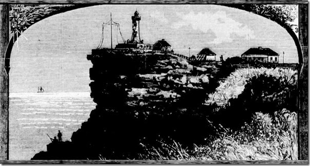
    A sketch of Cape St. George lighthouse done by “Raven” during his trip.
    lighthouse 


    Cape St, George Lighthouse.

           The St.George lighthouse stands on a bold rocky promontory, as the sketch will show, and is superintended by Mr. Gibson, son of Captain Gibson, who for 30 years was pilot of Port Jackson. The tower is of the most substantial character, being built of massive cut stone, and, along with the assistants’ cottages, the signal staff, the meteorological instruments and the flag-room, is enclosed within a stone wall 4ft high. It is connected with Mr. Gibsons private residence, and the assistance’ quarters by a system of electric bells. The lights, nine in number  ( three red, three green, and three white ), are revolved by means of a clock work, which regulated as circumstances require; these lights are visible for a distance of from 15 to 25 miles. A public school is within a short distance. From the summit of the tower a magnificent view of the whole of Jervis Bay, 30 Miles in circumference, and about eight miles across, is to be had.
    After partaking of Mr. Gibsons hospitality, we turn our faces homeward, and we are once more following the little-used track through some of the most barren land in Australia.
    Another part of his journey has come to an end, it is apparent from Ravens’ correspondence a days journey in this part of the country at that time was something you didn’t take to lightly.
    To be continued – Opinions as to the prosperous future sooner or later of Jervis Bay.
    p4
    After a few exciting days at Jervis Bay the Raven concludes his story, seeing a prosperous future for the Bay.
    Amongst the safest harbours of refuge on the east coast.
    Opinions as the the prosperous future sooner or later of Jervis Bay are, I think, unanimous. The Admiralty records place it amongst the safest harbours on the east coast, being accessible in all weathers, and the “Nautical Almanac” describes it as ‘superior to Port Jackson, inasmuch as a fleet of the largest ironclads might enter in any conditions under weather, and choose anchorage in from five to six fathoms close in shore.” Some short time ago there was talk of a railway being constructed by the Victorian company from one of the rich coal seams of the coast range – if I remember alright, from the Jamberoo mountain – to this bay; but here the matter ended. It is generally thought that the Illawarra railway will have a terminus here. In regard to the most suitable landing place on this bay, Mr. J. Brache, C.E., late superintendent of mining surveys to the Geological Department of Victoria says; ‘A close investigation of the various landing places in Jervis Bay has decided me in favour of the beach from Plantation Point south towards Darling Roads. There a high beach, with rocky projections, approaches within a short distance, to deep water. six fathoms and over, enough depth for the largest tonnage vessels; whilst the adjoining hills contain stratas of good sandstone to freestone, available for wharf, jetties, and all other building purposes.’
    The ‘Raven” has painted a picture of a beautiful, but harsh, and rugged landscape, interspersed with small pockets of activity of the early pioneers, it highlights the isolation and remoteness of Jervis Bay, but like so many other stories concerning the Bay from this period, the correspondents all come to the same conclusion, Jervis Bay has a prosperous future for industry and commerce if the infrastructures are built, the railway, and better shipping facilities being the main concerns.
    Its interesting to note, despite much talk and promises these things never materialised.
    Because of this inaction, we are fortunate to have the Bay the way it is today.
    Additional ref. http://home.exetel.com.au/tomerong/history2/index.htm
    http://home.exetel.com.au/tomerong/bullock/

    7 December 2014

    Bygone days in Huskisson.

    The Shoalhaven Telegraph 1922.
    Established in 1879 the Shoalhaven Telegraph reported on many and varied subjects. While researching other stories I come across some interesting news reports relating to Jervis Bay and the Shoalhaven.

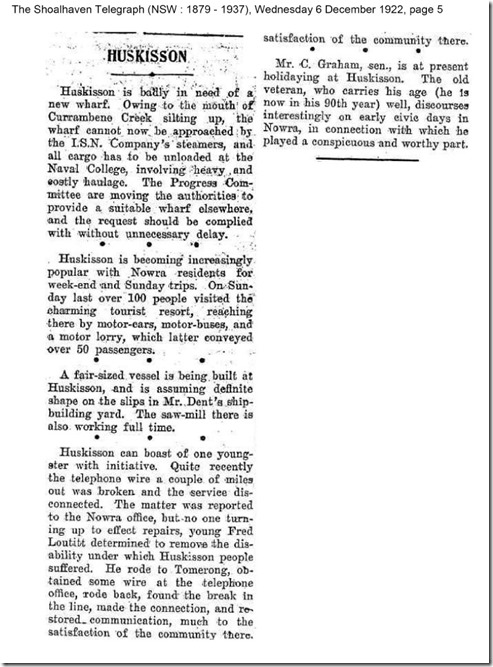
    Here is one simply titled “HUSKISSON”.
    These small news items give you a real insight into the daily lives and times in bygone days.
    Click image to enlarge.

    The Shoalhaven Telegraph (NSW : 1879 - 1937), Wednesday 6 December 1922, page 5

    Jervis Bay history snippets.

    Goulburn Evening Post 1948.
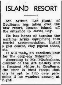
    Bowen Island, Golf course, clay pigeon shooting…
    Goulburn Evening Post (NSW : 1940 - 1954), Wednesday 3 March 1948, page 4

    Bowen Island forms the southern entrance to Jervis Bay.
    You might think this small island, home to the northern most colony of fiery penguins doesn’t offer to much, other than a nice photograph, but this small island has a unique history of it’s own and a story to tell.
    That story will be for a future post.

    6 December 2014

    Captain Cook 1770

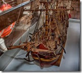
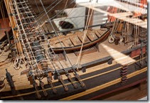
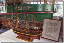
    On display in the museum at the moment we have a remarkably detailed model of the Endeavour and a large heavy iron ballast block from 1770, along with a written account of the moment the Endeavour ran onto the great barrier reef, goods had to be jettisoned including the ballast block on display to save the ship from being broken up upon the reef.
    captain-cook-model captain-cook-boat captain-cook-boat-2

    4 December 2014

    Hopper Punt.

    Not all the vessels built at Huskisson had the grace and outlines of the tall sailing ships or steam boats.
    The shipbuilders also built working punts, and in this case a Hopper Punt was launched at Huskisson in 1908.

    At 106ft long and 24ft wide and a carrying capacity of 300 tons it’s still quite a substantial vessel, taking many months to build and still had to endure being towed across open ocean with all that entails to Sydney Harbour.

    You might ask:- What is a Hopper punt?….I know I did!
    It’s a flat floored lighter for carrying soil or mud, with a hopper or receptacle in it’s centre, to contain the lading. – ( load or cargo )

    The Sydney Morning Herald (NSW : 1842 - 1954), Wednesday 24 June 1908, page 10

    SS Ventnor 1902

    Divers explore the wreck of the SS Ventnor that sank over 100 years ago, she has recently been found.

    In 1902 the ship Ventnor set out for China with the bones of 499 Chinese men who had died in New Zealand. The men were being returned home to the care of their families and ancestral villages.
    Tragically the men never made it.
    The Ventnor hit a rock off the Taranaki coast and eventually sank off the Hokianga Heads. This was a great catastrophe for the community, as it was believed the men’s spirits would not be at ease. Far from family and in a watery grave, there would be no-one to tend to their needs in the afterlife.

    Continue Reading.

    2 December 2014

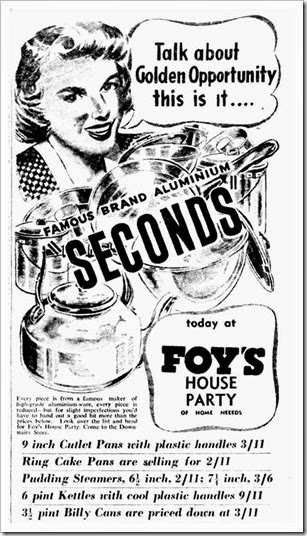
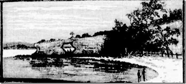
    1950. The Lady Denman was still working hard on Sydney Harbour, 44 years after her launch at Huskisson and 29 years after her expected working life was suppose to runout.

    A time when Aluminium was regarded as the cooking utensil of choice.
    Later to be discovered it contained chemicals that were detrimental to your health, and was gradually replaced with stainless steel.
    add

    1 December 2014

    Bygone days.
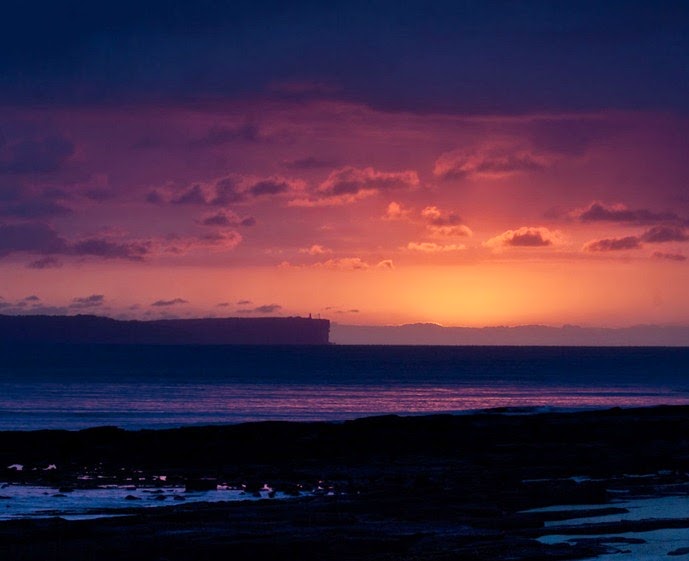
    I have been long fascinated by old advertising signs and adds. There a style that reflects an age gone by.
    I thought Id post a few adds that appeared in the same newspapers as some of the articles about shipbuilding, shipping misadventures and local community activities and stories that appear on this blog.
    This is from the Shoalhaven Telegraph dated 1919.
    kb-add-1919


    A relaxing semi rural scene showing a finely dressed business man easing back on the lounge and what looks like a well dressed farmer in his cane chair enjoying a cigarette and a refreshing ale. Designed to show the reader the different class of people KB Larger would appeal to.

    Local place Names.

    Do you sometimes wonder where the names of local places originated?
    Here a just a few that were transcribed by The Hon, Geo Thornton, MLC who is understood to be one of the best living authorities on the language of the Aborigines.

    Geo Thornton’s knowledge was arrived at from many years of camping with the Aboriginals about Wollongong, Kiama and Jervis Bay, he goes on.  “I dare to say that you know, too that the aboriginal dialect differed much within distances of 70 or 80 miles. For example the language of the Sydney aboriginals was quite unidentifiable to those of the Kiama and Shoalhaven.”

    Cooroombong – corrupted to Currumbene Creek.
    WandiwandianWandandian – means home of lost lovers.
    BerrewerriBehwerrie – a crossing place.
    Moonah – is the name of the inside of Jervis Bay.
    Booderee – that of the entrance between the heads of Jervis Bay.

    Currumbene Creek Huskisson.

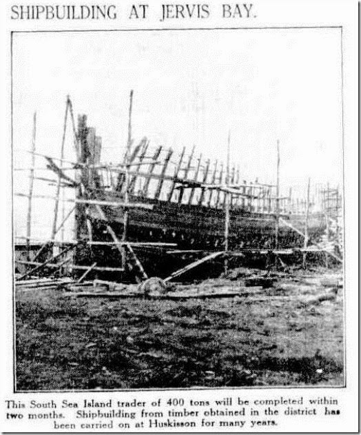
    An photograph of an un-identified ship in the yards at Huskisson from an old un-named newspaper.
    no more details were available at this time.
    article16931673-3-001